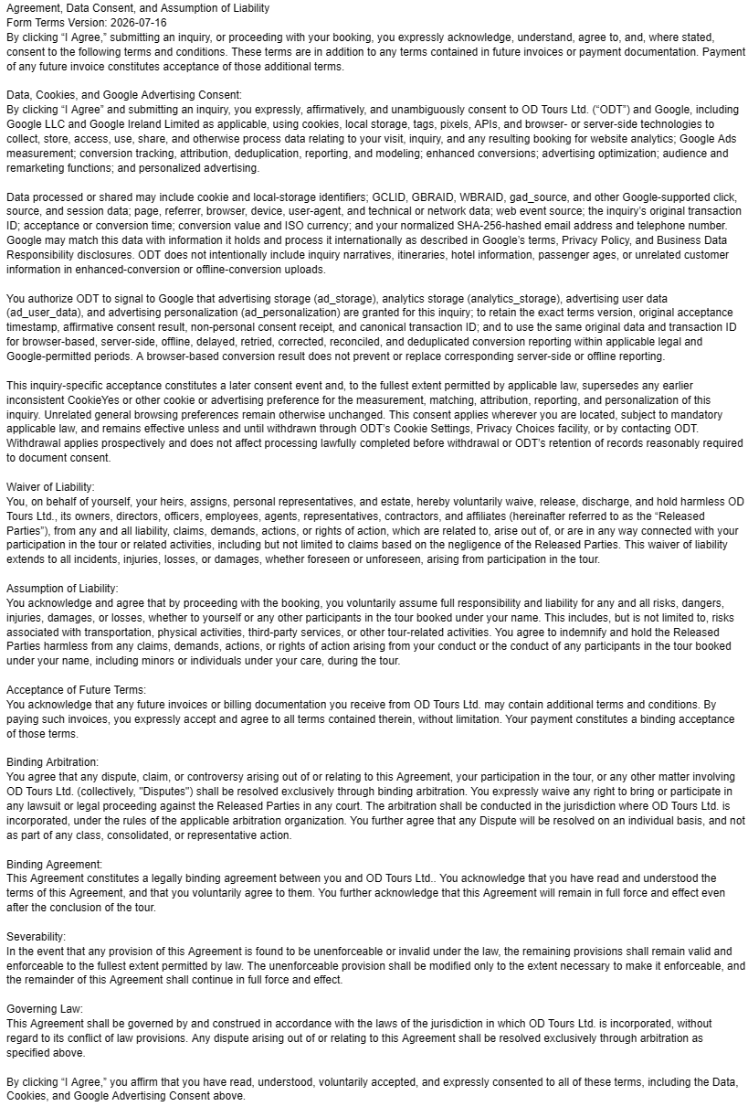
Paris Along the Meridian: The Observatory, Arago Medallions and the City’s Scientific Geography

Updated
Paris’s invisible north-south argument
On 21 June 1667, mathematicians of the newly founded Académie royale des sciences marked a north-south line on the ground chosen for the Observatoire de Paris. The permanent building was not yet the venerable institution visitors recognize from avenue de l’Observatoire; the coordinate came first. That sequence matters. Paris did not simply acquire an observatory and then use it to study the sky. Scientific authority was written into the site through alignment, measurement and the claim that one carefully established line could organize observations far beyond the city, as the Observatoire de Paris heritage chronology records.
Today, that line is difficult to perceive. It does not open as a grand vista, behave like a boulevard or survive as a continuous stripe. The historic interior at the Observatory is not an ordinary walk-in attraction. In public space, the best-known traces are small bronze medallions bearing the name Arago, dispersed in paving from the south of Paris toward the north. Some sit in conspicuous civic settings; others can be overlooked, obscured or separated from one another by long stretches of ordinary city. A visitor who merely collects discs will see fragments without understanding the system that made them meaningful.
The central question is therefore not “Where are all the markers?” but “How did one invisible line become an astronomical instrument, a national mapping reference, part of the metric project and, eventually, a work of public memory?” The answer requires four scales at once: the room-sized meridian instrument inside the Observatory; the geodetic arc measured across territory; the prime meridian used as an origin for French cartography; and Jan Dibbets’s late twentieth-century memorial distributed through the streets.
This guide treats those scales as one evidence chain. Its argument is that the Paris meridian remains legible not because the physical evidence is complete, but because each surviving element records a different phase in the authority of measurement. The Observatory establishes the line institutionally. Cassini astronomy and geodesy extend it across France. Revolutionary metrology uses an arc of it to pursue a supposedly universal unit. Arago embodies the passage from field measurement to public science. Dibbets then converts a missing heroic statue into a citywide memorial whose very fragmentation forces the viewer to reconstruct the line mentally.
That is a more demanding reading of Paris than a monument checklist, but it is also more revealing. It shows a city in which scientific history is not confined to a collection case. It runs beneath gardens, institutional walls, palace precincts and everyday paving, joining royal science, republican standardization and contemporary art without pretending those episodes were seamless.
The Observatory was designed around a coordinate
The official heritage history of the Observatoire de Paris records that Academy mathematicians laid out the Paris meridian on the site on 21 June 1667, and that Jacques Cassini completed the internal meridian line in 1729. That account describes a monumental instrument made from 32 brass rules set into white marble. The point was not ornamental geometry. A solar image admitted from above could cross the line, allowing observers to work with the Sun’s position and local noon. The Observatoire de Paris heritage account is the essential documentary anchor for distinguishing this interior instrument from the later medallions outside.
Several ideas that are often blurred together should be separated. A meridian is, first, an imaginary line joining the poles. At a particular place, its plane defines north and south and provides the basis for observing when a celestial body crosses the local meridian. A meridian line laid into a floor is a physical instrument for reading such passages, especially the Sun’s. A prime meridian is a chosen zero from which longitudes are counted. A measured meridian arc is a geodetic operation across a section of Earth. The Paris story contains all four, but they are not interchangeable.
The Observatory’s architecture made those distinctions tangible. The building was not simply a container for telescopes. Its orientation, rooms and sight lines participated in observation. The brass-and-marble line in the Cassini room turned the movement of the Sun into an event registered against a fixed surface. In conceptual terms, the sky entered the building and was converted into a reading. That conversion is one reason the site belongs to the history of instruments as much as to architectural history.
The Cassini name also represents more than one astronomer. Across generations, members of the Cassini family worked at the Observatory and helped bind astronomical observation to geodesy and cartography. The line through Paris became a practical axis for work on the shape and dimensions of the Earth and for the triangulations used to map France. The great national cartographic enterprise remembered as the Carte de Cassini was one result of that multigenerational system. It is misleading to imagine a single heroic act in which the country was “measured” once. The achievement was cumulative: observations were repeated, baselines checked, triangles extended, calculations revised and maps assembled over long periods.
That institutional continuity is the first interpretive payoff of the site. The meridian was authoritative because it could be revisited. A point established by a court-sponsored academy became durable through procedures, instruments, records and trained observers. The line’s power did not lie in being naturally privileged. No feature of the Earth declares that longitude must begin in Paris. Its force came from a network able to make the convention useful.
For travelers interested in how buildings become machines for knowledge, this is a useful companion to an architecture-led reading of Paris. The Observatory asks a different architectural question from a boulevard or Métro entrance: not how a form represents the city, but how a building fixes a coordinate and supports repeatable observation.
What the meridian did for astronomy, maps and state knowledge
A prime meridian is a convention, but conventions can have enormous practical consequences. Longitudes require an agreed origin. Maps need a framework within which places can be related to one another. Astronomical observations require time, position and carefully defined reference systems. Once Paris served as the French origin, the meridian through the Observatory became more than a local line: it was a zero embedded in tables, surveys and maps.
Lucie Lagarde’s historical study of the prime-meridian problem in France is valuable because it refuses to treat the choice as a purely technical matter. It frames prime meridians as simultaneously geographic, mathematical, practical and political. Different origins could serve different states and mapping traditions, while questions of navigation, time and territorial representation pushed toward wider agreement. The Paris meridian’s history therefore belongs to the politics of standards as well as to astronomy. See the scholarly account at Revue d’histoire des sciences.
The distinction between a local meridian and a national framework becomes clearer when one considers triangulation. Surveyors did not draw a perfectly straight line across the landscape and measure it end to end. They established accurately measured baselines, observed angles between visible points and built chains of triangles. Astronomical observations helped determine latitude and orientation. The meridian supplied an organizing axis, while the network converted selected stations into a coherent geometry.
- At room scale, the meridian line registered celestial passage against a fixed instrument.
- At urban scale, the Observatory fixed a reference through Paris.
- At territorial scale, triangulation related distant points and supported national mapping.
- At international scale, competing meridian origins exposed the need for shared standards.
This is why “the Paris meridian” can sound deceptively singular. The phrase names a geometric line, but its historical effect came from the work around it: instrument making, observing, calculating, publishing and administrative adoption. The line could organize a map only because institutions agreed on methods and preserved results. Its authority was enacted rather than merely discovered.
There is also a useful tension between map and ground. A map presents a finished surface: roads, rivers, boundaries and settlements appear as if they were already available to be read. The survey process was the opposite. It involved uneven terrain, limited visibility, weather, instrument error, access negotiations and mathematical reduction. The clean geometry of the final map concealed the labor required to make places commensurable.
That tension survives in Paris. The modern visitor sees a neat brass disc or a clear line on a diagram, yet the scientific history behind it is full of correction and disagreement. The meridian should not be romanticized as an infallible axis. It was useful precisely because observers could test, extend and revise measurements made in relation to it.
Measurement meant triangles, instruments and managed error
The strongest way to understand the meridian is to imagine a chain of evidence rather than a line of paint. A baseline of known length allows surveyors to calculate other distances from measured angles. Successive triangles carry the network across country. Astronomical observations connect the network to latitude and direction. Calculations then translate field readings into coordinates. Every stage introduces possible error, so repetition and comparison are not secondary chores; they are the substance of precision.
This helps explain why the Observatory mattered even when much of the work happened far from Paris. It provided institutional continuity, instruments, records, mathematical expertise and a recognized origin. A survey point on a hill, a brass rule in a room and a coordinate printed on a map belonged to the same system only because procedures connected them.
It also clarifies the relationship between astronomy and geography. Before satellite positioning, determining a place on Earth depended heavily on observations of the sky. Latitude could be related to the altitude of celestial bodies; longitude required comparison of time. The Earth was measured by looking away from it. The Observatory’s meridian was therefore not an abstract line imposed on geography from a desk. It was part of a practice in which celestial regularity helped organize terrestrial space.
The scientific stakes extended beyond locating towns. Meridian-arc measurements contributed to debates about the figure of the Earth. If degrees of latitude corresponded to different ground distances at different latitudes, that difference bore on whether the planet was perfectly spherical or flattened. Eighteenth-century expeditions and repeated measurements made geodesy a field in which mathematical theory, difficult travel and instrument performance met.
For the city reader, the important lesson is that precision has a social geography. It depends on places where instruments are calibrated, observers trained and results authorized. Paris functioned as one such center. The meridian’s national role did not mean every measurement occurred within the capital; it meant the capital supplied a reference and an institutional language through which distant measurements could be combined.
This is also why a private, specialist-led walk can produce more value than an unguided search for plaques. The visible evidence is sparse, but the interpretive work is dense. A knowledgeable guide can move between what is physically present, what the archival record establishes and what remains a reconstruction. That separation protects the story from two common errors: treating every north-south marker as part of the same instrument, and presenting the city as if a continuous, fully preserved scientific route had always existed.
The metric project turned a national line toward a universal claim
The French Revolution gave the meridian a new role. Reformers wanted units that did not depend on a particular ruler, province or customary object. The metre was conceived through the Earth itself: the intended unit was one ten-millionth of the quarter of a terrestrial meridian between equator and pole. Jean-Baptiste Delambre and Pierre Méchain carried out the geodetic survey of the Paris-meridian arc between Dunkirk and Barcelona from 1792 to 1798. The International Bureau of Weights and Measures account identifies that survey as the basis of the original definition of the metre.
The apparent paradox is productive. A unit presented as universal emerged through French institutions, a meridian passing through Paris and a field campaign carried out amid revolution and war. “Natural” did not mean free from politics or administration. It meant that the proposed standard was justified by reference to the Earth rather than to a monarch’s body, a local market measure or an inherited artifact. To transform that principle into a usable unit still required state support, scientific commissions, instruments, travel, calculation and the production of material standards.
The survey itself should not be imagined as measuring a tape from Dunkirk to Barcelona. Delambre and Méchain worked through triangulation and astronomical determinations, connecting stations across a long arc. Their observations were reduced mathematically so that a portion of the meridian could be extrapolated into the larger terrestrial quadrant on which the definition depended. The process joined field geometry to a philosophical ambition: people in different places should be able to share a unit because it referred, at least in principle, to the same planet.
That ambition makes the Paris meridian more than a defeated rival to Greenwich. Greenwich eventually became the internationally dominant prime meridian, but the importance of Paris is not exhausted by the question of which zero “won.” The Paris line had already helped organize national cartography and had become central to one of the most consequential standardization projects in modern history. Its legacy survives whenever measurement is expected to be coherent across jurisdictions, even though modern metrology no longer asks surveyors to reproduce the metre by remeasuring the Earth.
There is a deeper historical tension here. The metric system promised liberation from arbitrary local measures, yet it also expanded the capacity of centralized institutions to regulate commerce, engineering, taxation and administration. Standardization makes exchange easier and comparison more reliable; it can also make diverse practices answerable to a single system. The meridian therefore belongs to both enlightenment universalism and the growth of the modern measuring state.
For a visitor standing over an Arago medallion, this is the essential context. The disc does not commemorate an isolated astronomical curiosity. It marks the urban trace of a reference line that participated in converting territory into coordinates and the Earth into a standard. Once that chain is understood, the smallness of the object becomes appropriate: an unobtrusive piece of metal can refer to a system far larger than any conventional statue.
Why François Arago’s name belongs on the line
François Arago did not create the Paris meridian, and he should not be credited with the entire metric survey. His relevance is more specific and more interesting. After leaving the École Polytechnique, he joined the Observatoire de Paris. In 1806 he went to Spain with Jean-Baptiste Biot and the Spanish commissioner José Rodríguez to continue the meridian-arc work begun by Méchain, extending the operation toward the Balearic Islands. He later became director of the Observatory in 1843 and was a prominent teacher and public communicator of astronomy. The Académie des sciences’ biographical notice connects those roles directly.
Arago therefore stands at a junction. He was a field geodesist, observatory astronomer, physicist, institutional leader, popular lecturer and politician. His name can carry the meridian story from precision measurement into public culture. That breadth also explains why a nineteenth-century commemorative statue could treat him as a civic hero rather than as a narrowly specialized scientist.
The statue, erected in 1893 on place de l’Île-de-Sein opposite the Observatory gardens, did not survive. A Paris council record states that it was removed and melted in 1942 during the Occupation, leaving the pedestal. The same record explains that, in 1990, an association linked to Observatory figures approached the City of Paris and the Ministry of Culture about a new commission. The surviving plinth is therefore not an incidental ruin. It is the hinge between two commemorative systems: a lost bronze figure elevated above the street and a later work dispersed through the ground. See the official Paris council record.
The contrast is powerful. A traditional statue concentrates memory in one likeness. It asks the viewer to identify and honor a person. The Dibbets work distributes memory along the geographic object with which Arago was associated. It asks the viewer to follow, infer and connect. One mode is biographical and vertical; the other is spatial and horizontal.
Neither mode is neutral. The statue promoted the great-man language of nineteenth-century public commemoration. The medallions can seem more democratic because they occupy ordinary paving, but they also make interpretation harder. Without prior knowledge, “ARAGO” may be only a name underfoot. The work’s sophistication is inseparable from its opacity.
That opacity is precisely where a cultural route earns its depth. Arago becomes not the sole inventor of the story but its human connector. His career permits a discussion of how scientific authority moved between field campaigns, the Observatory, classrooms, academies and government. It also provides a bridge to another Parisian scientific history: how Paris became a laboratory for photography, where Arago again appears as an institutional advocate rather than a solitary maker.
Jan Dibbets turned a missing statue into distributed public memory
The commission awarded to the Dutch artist Jan Dibbets did not replace the lost statue with another figure. It materialized the meridian through bronze medallions engraved with Arago’s name and inserted into Parisian ground. This was a conceptual solution to a historical absence: rather than reconstruct a likeness for which no adequate model survived, the new work attached Arago to the measured line itself.
Official records do not present a perfectly uniform count. The 2008 council debate describes a project of 115 medallions. A current Ville de Paris page, updated on 30 July 2026, states that 135 medallions materialize the meridian through the capital. The safest reading is not to force those figures into a false certainty. The council transcript documents how the project was described in that debate; the newer city page gives the municipality’s current public account. For route planning, neither should be treated as a guarantee that a traveler can locate a complete inventory in the pavement.
This discrepancy is not a nuisance to hide. It reinforces the article’s larger point: distributed public art is vulnerable to maintenance, resurfacing, loss, inconsistent documentation and changing descriptions. A monumental bronze in a square is easy to count. A citywide work embedded in active surfaces is harder to preserve as a single, stable object. Its material condition is inseparable from the ordinary life of streets and gardens.
Editorially, the Dibbets work can be understood as an anti-monument, but that term should be used as interpretation rather than as a promise of what every viewer will feel. Its scale is metropolitan, yet each component is modest. It commemorates a person without showing his face. It marks a line that cannot be seen between points. It directs attention downward while referring to astronomy and the shape of the Earth. It is both exact in concept and fragmentary in encounter.
The work also changes the meaning of “site.” The memorial is not located at one address. Its site is a relationship among many places aligned by a coordinate. A garden path, a palace precinct and a pavement near the Observatory become parts of the same artwork only when the viewer understands the meridian. This is public memory as a network rather than a destination.
That networked form suits the history unusually well. The science behind the meridian also depended on distributed points: observatories, baselines, hilltop stations, signal locations and mapped coordinates. Dibbets’s medallions do not illustrate triangulation literally, but they echo the idea that knowledge can be made from separated marks whose relation matters more than any single object.
The public-art layer therefore completes rather than decorates the scientific story. Cassini’s line made celestial motion readable in an interior. Geodesists extended measurement across territory. The metric project connected the arc to a universal unit. Dibbets reversed the movement, bringing the abstract coordinate back into the pedestrian city. What had once been an expert reference became a public trace—still dependent on expertise, but available to anyone willing to look down and ask why it is there.
How to read one medallion without turning the route into a hunt
A single medallion proves less than many visitors assume. It does not mark the location of an astronomical discovery, a survey station used by Cassini or a place where Arago necessarily stood. Its primary role is relational: it indicates the course of the meridian and belongs to a distributed memorial. The scientific history sits behind the alignment, not beneath each disc as a separate episode.
The best method is to read each marker through three questions. First, what kind of place has received it: garden, institutional threshold, ceremonial court or ordinary paving? Second, what does the surrounding geography contribute to the story? Third, which historical layer is visible here and which must be supplied through documents or interpretation?
At the Observatory, the line is tied to institutional astronomy and the missing statue. In Parc Montsouris, it can be compared with other scientific traces and with the city’s southern landscape. Around the Louvre and Palais-Royal, the marker enters spaces of royal power, museum culture and public ceremony. The same object changes meaning because its setting changes.
It is also worth resisting false precision. Published maps and lists can become outdated as paving changes. A marker may be present but difficult to see, absent from an expected spot or located inside a zone with its own opening conditions. The route should be successful even if no one finds every disc. Its purpose is to make the meridian intelligible through selected evidence, not to score completeness.
This approach separates observation from inference. “There is a bronze disc here” is an observation. “It belongs to Dibbets’s memorial” is an identification supported by the work’s documentation. “Its modest scale criticizes heroic monumentality” is an interpretation. Keeping those levels distinct makes the walk intellectually stronger and prevents attractive readings from being presented as settled fact.
A south-to-center evidence walk
The most coherent public route begins in the south and ends near the historic center. It does not attempt the full urban course of the meridian. Instead, it selects four evidence zones that allow the story to build in sequence: landscape and sighting at Parc Montsouris; institutional authority at the Observatory; civic passage through the Luxembourg area; and the collision of scientific reference with palace and museum geography around the Louvre and Palais-Royal.
1. Parc Montsouris: begin with a line that is not obvious
Parc Montsouris is a strong opening because the landscape initially seems to resist the subject. Its slopes, lawns, trees and curving paths do not look like a coordinate system. Yet the Ville de Paris states that the Paris meridian crosses the park and uses the Arago medallions to explain how the abstract line is materialized in the capital. The park makes the first point vividly: a meridian can govern geographic description without appearing as a visible corridor. The official city page is at Ville de Paris: Parc Montsouris and the meridian.
Do not begin by counting discs. Begin by establishing orientation. The meridian is a north-south reference crossing a designed nineteenth-century park laid over older quarry terrain. Once that geometry is understood, a medallion becomes evidence of a conceptual intervention in an irregular landscape rather than a decorative curiosity.
The Mire du Sud adds a specialist corrective. A municipal neighborhood history of the site explains that this tall sighting marker is not exactly on the Paris meridian. It served the alignment of Observatory instruments that were themselves offset, so its position responds to a specific optical relationship rather than to the prime line in the abstract. That distinction is invaluable: two nearby objects can both belong to Observatory history while marking different alignments.
This is an ideal early lesson in scientific reading. Visual prominence does not guarantee conceptual primacy. The large stone marker may seem more authoritative than a small bronze disc, yet each refers to a different operation. A guide should make the offset explicit rather than smoothing it into a simpler story.
2. The Observatory and place de l’Île-de-Sein: institution, absence and memory
Continue north toward the Observatoire de Paris and place de l’Île-de-Sein. Here the route’s historical layers compress. The Observatory is the institution through which the meridian gained authority. The place preserves the pedestal of the nineteenth-century Arago statue. Dibbets’s intervention connects that absence to the line running through the city.
The most important exterior task is not to manufacture a view into inaccessible interiors. It is to read boundaries and alignments. The Observatory’s walls remind the visitor that scientific work occurred within a controlled institution. The empty plinth records a rupture in civic commemoration. The medallions transfer attention from the absent figure to the geographic line. In a small area, the visitor can move from royal scientific foundation to nineteenth-century hero-making and then to late twentieth-century conceptual art.
This stop is also where the temptation to overstate access must be resisted. The Cassini meridian line is historically central, but it should not be described as a guaranteed part of an ordinary visit. The exterior route is complete enough to support interpretation even when the building is closed. An announced opening, when available, is an enrichment rather than a premise.
3. Luxembourg: the meridian enters civic landscape
North of the Observatory, the line passes into the Luxembourg area. This section is useful because it softens the institutional concentration of the previous stop. Gardens, paths, state buildings and everyday movement occupy the same geography. The meridian becomes less like a scientific campus axis and more like an invisible coordinate passing through urban life.
Here, treat any surviving medallion as a pause rather than a prize. Ask what changes when the line crosses a garden associated with leisure, political institutions and carefully composed vistas. The coordinate does not organize the visitor’s view in the same obvious way as the garden’s designed axes. Scientific and landscape geometries overlap without becoming identical.
This is also a good place to explain why the Paris meridian should not be confused with every north-south avenue nearby. Urban routes respond to property, topography, design and traffic; a geodetic line ignores those practical negotiations. Where streets diverge, the meridian continues conceptually through buildings and enclosed spaces. The gaps in the medallion sequence are therefore not failures of geometry. They reveal the difficulty of translating a global line into a lived city.
4. The Seine, Louvre and Palais-Royal: a coordinate crosses power
Continue toward the Seine and the Louvre-Palais-Royal precinct. This is the route’s strongest symbolic contrast. The meridian, born from an academy sponsored by royal power, passes through or beside spaces that became central to the museum city and the public representation of the nation. Small markers occupy ground dominated by architecture, collections and ceremony.
A medallion near the Louvre does not mean the museum itself explains the meridian. Its value is contextual. It lets the visitor ask how scientific authority related to court, state and public institutions. The answer is not a simple progression from monarchy to republic. The Academy, Observatory, metric commissions, museums and municipal art programs all depended on different forms of public authority. The line connects them spatially while the historical interpretation must preserve their differences.
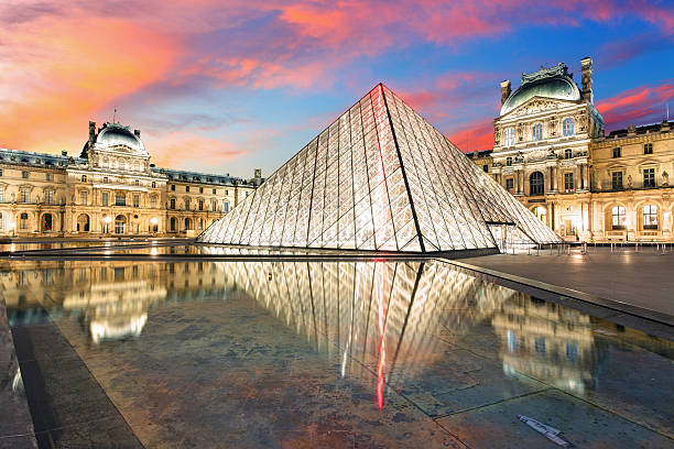
The Louvre precinct can also be read through the Louvre before it became a museum. That supporting history makes the meridian’s passage through central Paris more legible: the coordinate meets a site repeatedly remade from fortress to palace to public collection, just as the line itself moved from observatory reference to national standard and public memorial.
Palais-Royal offers a sensible stopping point. By then, the evidence chain is complete: landscape, instrument history, institution, lost statue, distributed artwork and central-state geography. Continuing north can extend the work, but it is no longer necessary to understand the thesis. Ending here protects the route from becoming a fatigued search for additional discs.
Optional indoor anchors, with an essential access caveat
The Observatoire de Paris is the most important possible interior, because the Cassini room and its meridian line bring the scientific mechanism into view. It is also the least appropriate place on which to build an unconditional itinerary. The Observatory’s official visit page states that the Paris and Meudon sites receive the public during announced open days or other special events; the Paris site opens for the European Heritage Days with registration. Check the official Observatoire de Paris visit page for the current program.
The correct planning consequence is straightforward. Do not advertise continuous public access, and do not make the interior the route’s only source of meaning. Build the walk so that the Observatory exterior, the plinth, the public-space markers and the archival evidence already form a complete argument. When a legitimate opening aligns with the visit, the interior can become the culminating proof of how the line functioned as an instrument.
A second optional indoor anchor is the Musée des Arts et Métiers, not because it lies on the meridian—it does not serve as a point on the line—but because its history-of-technology context can help visitors understand precision instruments, geodesy and the material culture of standardized measurement. Current displays should be checked rather than assumed; the museum’s material on the history of the metre shows why it is a relevant comparison. Its role is comparative: it supplies instrument literacy that makes the outdoor evidence more intelligible.
A third anchor is digital rather than physical. The Observatory’s heritage library allows the traveler to see the documentary and material history before or after the walk. For a specialist audience, this is not a lesser substitute. Archival images, descriptions of the meridian line and institutional histories can resolve questions that the street cannot answer. The city route then becomes a field exercise in matching present surfaces to historical records.
The Louvre can be included as an indoor stop only for a separate reason: art, palace history or the institutional transformation of royal collections. It should not be forced into the meridian story merely because markers appear in the precinct. The same discipline applies to every optional interior. It must add a distinct evidentiary layer, not simply offer shelter or prestige.
For a larger Paris stay, the meridian route sits well beside a broader cultural plan such as a three-day Paris itinerary with private guides. The scientific walk is best treated as a focused half-day study rather than diluted among unrelated highlights.
What the route reveals about Paris
The first revelation is that scientific geography is not the same as urban form. Paris does not announce the meridian with a continuous avenue. The line passes through spaces built for other purposes, and that mismatch is historically productive. It demonstrates the difference between an abstract coordinate and a city assembled through property, power, design and use.
The second is that standards are cultural artifacts. The prime meridian and the metre may be expressed mathematically, but their authority depended on institutions, instruments and political adoption. They became durable because communities agreed to use, reproduce and teach them. The route makes that social infrastructure visible.
The third is that public memory can be more accurate when it admits fragmentation. A reconstructed heroic statue might have restored a familiar civic image, but Dibbets’s distributed work better matches the meridian’s spatial logic. It also leaves the rupture of 1942 visible through the empty plinth. The city remembers Arago through both presence and absence.
The fourth is that Parisian scientific history is not a minor theme appended to art and architecture. It shaped how territory was mapped, how units were standardized and how the state represented space. The Observatory belongs in the same serious conversation as palaces, museums and churches because it helped define the coordinate systems through which the modern world was administered.
Finally, the route shows why expertise matters most when evidence is dispersed. None of the individual objects is difficult to describe. The challenge is relating them without collapsing distinctions: meridian line versus prime meridian; Observatory instrument versus geodetic arc; Delambre and Méchain versus Arago; stone sighting marker versus Dibbets medallion; archival count versus surviving field evidence. A coherent interpretation depends on preserving those differences while showing how they connect.
Reading the meridian as one coherent urban story
For science-history travelers who read cities through measured space, the Paris meridian offers an unusually rich subject. It begins with a seventeenth-century institution that aligned architecture to observation. It expands through Cassini geodesy and national mapping. It enters revolutionary metrology through the Dunkirk-to-Barcelona survey. It acquires a human intermediary in Arago, whose career joined field measurement, the Observatory and public science. It returns to the pavement through Dibbets’s medallions.
The route is strongest when those phases are presented as an argument rather than as chronology alone. Scientific authority moved from a fixed room to a territorial network; universal measurement emerged through national infrastructure; a missing statue became a distributed memorial; and an invisible coordinate became readable through fragments. Paris did not preserve the line perfectly. It preserved enough evidence to show how measurement became culture.
A tailored private walk is relevant at the point where the traveler wants those scattered traces interpreted as one system. The value lies in source-aware explanation, careful distinction and a route paced around evidence rather than around marker accumulation. Orange Donut Tours can shape that specialist reading within private Paris touring and coordinate the public-space sequence with any legitimate special opening that happens to be available. Inquire now
If you’re interested in any private tours of Paris, please reach out to us.











 So if you are looking for the absolute best in Paris & surroundings with authentic local fully-licensed native guides whose English you can actually understand and with an exclusive and amazingly fun itinerary