When Winter Swell Reaches Nazaré: A Lisbon Excursion Built Around Viewing Conditions, Not Wave Promises

Updated
A spectacular forecast can still produce a failed day
Imagine leaving Lisbon before the city is fully awake because a large number appeared on a surf forecast. By the time the car reaches Nazaré, low cloud has erased the horizon, crosswind is driving spray across every exposed lens, the most useful public viewpoint is temporarily unavailable, and the visible sets are arriving at an angle that reads poorly from the place where the group has stopped. The party waits for a photograph that the forecast never actually promised. Then the short winter afternoon begins to close, and the only alternative is invented from the roadside.
That is the failure this excursion should be designed to prevent. A Nazaré photography day is not an appointment with a particular wave height. It is a conditional Atlantic-observation day in which swell, wind, visibility and lawful access must all cooperate enough to make shore-based viewing worthwhile. The correct outcome may be a strong coastal session from Sítio da Nazaré, a shorter move between viewpoints, a restrained documentary study of weather and headland, or a full inland switch to Alcobaça. What matters is that each outcome has been considered before the car leaves Lisbon.
For returning Lisbon visitors, that distinction is decisive. Someone who has already covered the capital’s major monuments does not need a generic northbound outing padded with unrelated stops. The day should answer a more exact question: are the current conditions good enough to justify concentrating on Praia do Norte and the Sítio headland, and, if not, can the same route still deliver a substantial visual and cultural subject? This guide treats Nazaré as a forecast-led field assignment rather than a spectacle to be ordered in advance.
The approach also complements our guide to winter light photography in and around Lisbon. That guide helps with composition under Atlantic light closer to the city. Nazaré demands a different discipline: separating marine energy from local viewing quality, then making a proceed, relocate or replace decision without crossing safety barriers or pretending that a forecast guarantees an image.
Nazaré is a condition, not a calendar date
Winter is the relevant planning season because the North Atlantic is more likely to send energetic swell toward the Portuguese coast during the cooler, stormier part of the year. That seasonal baseline is useful, but it is not an operating instruction. There is no calendar date on which a visitor can responsibly promise giant surf, clear sightlines or public access to a preferred viewpoint. Even within a period of active Atlantic weather, one day may be visually impressive and manageable, while the next is obscured, excessively exposed or restricted.
A serious plan therefore starts with conditions rather than reputation. The question is not simply whether waves are forecast. It is whether the forecasted sea state is likely to be observable from shore, from a lawful position, during the daylight window available to a group driving from Lisbon. A large offshore number with poor visibility can be less useful than a more moderate sea with clean light and a readable horizon. Strong onshore wind can make a theoretically dramatic scene unpleasant, unstable and difficult to photograph. A viewpoint closure can turn an otherwise promising forecast into the wrong day for the intended composition.
This is where language matters. “Big-wave day” sounds like a product. “Conditional coastal-observation day” describes the actual undertaking. The latter makes room for uncertainty without reducing the trip to a hedge. It also gives the photographer permission to value more than a single heroic frame: wave trains approaching the headland, white water tracing the shoreline, wind moving spindrift, the relation between Sítio and Praia do Norte, or the contrast between an exposed coast and the ordered stone spaces of Alcobaça.
The seasonal trigger should therefore be expressed as a sequence. First, Atlantic systems create the possibility of meaningful swell. Second, a near-term marine bulletin identifies wave direction and height alongside wind and visibility. Third, local access and viewpoint status determine whether that marine possibility can be observed safely. Only after those checks should the Lisbon departure be treated as a coast-first day. The season opens the question; it does not answer it.
Read three separate uncertainties before leaving Lisbon
The most common planning error is to collapse swell, wind and visibility into one idea called “weather.” They are related, but they do not answer the same question. The IPMA maritime bulletins are useful precisely because the inspected format separates warnings, issue and validity times, wind, visibility, and wave direction and height by maritime zone. That structure should become the structure of the excursion decision.
Swell: energy approaching the coast
Swell tells you that wave energy is arriving, but it does not tell you exactly what a shore observer will see from a particular position. Forecast wave height is not a guaranteed breaking-wave face. Direction, period, local bathymetry, interacting wave fields and the shape of the coastline influence how that energy appears near shore. At Nazaré, the canyon and headland create an exceptional setting, but “exceptional setting” is not the same as “automatic result.”
For planning, swell should be read in at least three ways. Direction helps indicate how directly the energy is approaching the exposed coast. Height indicates the scale of the sea state offshore, not the dimensions of a photograph. Period, where available in the chosen forecast product, helps distinguish closely packed wind sea from longer-travelled energy. A photography party does not need to become a surf-forecasting team, but it does need to resist a single-number decision.
The practical question is whether the expected sea will make the headland and Praia do Norte visually legible from public observation points. Moderate swell can still produce excellent structure, repeated lines and scale references. Very large swell may create more drama but also more spray, more restrictions, more crowd pressure and fewer usable positions. The excursion should not reward the largest number; it should reward the strongest combination of marine interest and observable conditions.
Wind: what the air does to the sea and the photographer
Wind changes both the water surface and the working environment. It can groom wave faces or tear them apart, carry spray toward or away from the observer, shake long lenses, fill exposed equipment with salt, and make a high promontory difficult for some travelers to tolerate. A wind direction that is visually favorable at water level may still be uncomfortable on the exposed route toward the fort. A calmer forecast can sometimes produce better concentration, cleaner equipment handling and a longer usable session than a more dramatic but punishing one.
Wind also introduces a route consequence. If the upper headland is excessively exposed, a lower or more sheltered public position may become preferable, provided sea reach and official restrictions allow it. If the lower coast is receiving heavy spray or sand, the elevated Sítio perspective may be more useful. This is why the day needs mobility between legal viewing positions rather than a single fixed stop.
Readers planning several Atlantic-facing days should also consult how Atlantic wind can alter a Lisbon day. The overlap is not the destination but the operational lesson: wind is not background atmosphere. It changes comfort, equipment use, sightlines and the order in which coastal places should be attempted.
Visibility: whether the scene can be seen at all
Visibility is the most underappreciated uncertainty because it is easy to assume that a large sea will announce itself through any weather. It may not. Low cloud can flatten the headland. Rain bands can erase the far line of incoming sets. Haze and spray can reduce contrast until the scale of the scene becomes hard to read. A coastal warning may concern marine conditions while the photographic failure comes from a much simpler problem: there is no clean visual separation between water, air and land.
Visibility must be checked twice. The first check is before departure, using the marine and general forecast. The second is close enough to the decision point that changing cloud, rain and spray can still alter the plan. The district warning timeline at the IPMA coastal-warning page includes Leiria, the district containing Nazaré, and displays warning status by time block. The page states that its times are UTC, so the group should read the validity window carefully rather than glancing only at a warning color.
A visibility failure is not always a reason to abandon the coast immediately. If the cloud is moving, a short, defined wait may be sensible. If the horizon is repeatedly opening and closing, the headland can still produce atmospheric work. But the waiting period should have a limit. Without one, the excursion becomes an indefinite roadside vigil that consumes the daylight needed for Alcobaça.
Why the canyon matters, and why it does not guarantee a result
Nazaré’s reputation is inseparable from the submarine canyon, but the useful planning point is geographical rather than promotional. The Portuguese Hydrographic Institute’s MONICAN description of the Nazaré Canyon places the canyon head less than one kilometre southwest of Sítio at approximately 50 metres depth and explains that its near-coast position and morphology significantly influence local hydrodynamic and sedimentary processes. That proximity helps explain why Sítio is not merely a high balcony above an ordinary beach. The submarine landscape reaches unusually close to the headland and affects how energy behaves near shore.
For the visitor, the canyon should be understood as a reason to study the site, not as a mechanism that can be switched on. A forecast showing substantial swell elsewhere on the Portuguese coast does not tell you exactly how the scene will resolve at Praia do Norte. The visible result depends on the relationship among incoming energy, local geometry, wind, tide and the observer’s position. That is why dramatic historical footage is a poor itinerary tool: it proves what the place can do, not what it will do on your chosen morning.
The canyon also changes what counts as a successful photograph. A tight frame of a single breaking wave may be the image most associated with Nazaré, but the broader geographic story is often more reliable. From elevation, a photographer can show the line of the headland, the exposed beach, vessels or structures for scale when present, and the successive bands of white water. Those elements explain the place even when the sea is not producing a record-scale moment. They turn the excursion from a hunt for one spectacle into a study of how a coastal system reads in space.
This broader approach is particularly appropriate for repeat visitors to Lisbon. It substitutes interpretation for checklist collecting. The goal is not to return with proof that Nazaré was “big” on a certain date. It is to understand why the headland, canyon, beach and weather must be read together, and to make photographs that show that relationship honestly.
Sítio and Praia do Norte answer different photographic questions
“Go to Nazaré” is not a sufficient location instruction. The excursion revolves around two related but distinct observation environments: the elevated Sítio da Nazaré headland and the lower Praia do Norte coast. They differ in angle, exposure, scale and safety margin. A strong plan decides which one to test first, what evidence would justify relocating, and what access limits end the discussion.
Sítio: geography and scale
Sítio gives the photographer the wider argument. From the headland, the sea can be read in relation to Praia do Norte and the promontory. Elevation reveals repeated wave lines, the direction of approach and the distance between offshore energy and shoreline impact. It is usually the more intelligible position for showing why the place is unusual, especially when the objective is not merely a close view of water but a visual explanation of landscape.
The tradeoff is exposure. Elevated ground receives wind before lower streets do. Spray and low cloud may obscure the beach. The walk toward the farthest public viewing areas can feel very different from the more protected interior of Sítio. A party carrying long lenses should treat the upper route as a field location, not as a casual overlook: secure loose items, allow time for careful footing, and accept that some members may prefer a less exposed public position.
Sítio also offers an early diagnostic advantage. From above, the group can assess whether the coast is visually readable before investing time in a lower reposition. If incoming lines, beach and headland cannot be distinguished from elevation, descending is unlikely to create clarity unless the visibility problem is very local. If the elevated view is strong but lacks foreground texture, Praia do Norte may become a deliberate second position rather than a hopeful search.
São Miguel Arcanjo fort: privileged position, conditional access
The municipal tourism page for Forte de São Miguel Arcanjo and its lighthouse places the fort on Estrada do Farol in Sítio, describes its promontory setting and privileged view over Praia do Norte, and notes the Nazaré Canyon Interpretation Centre inside. Those facts make it an important interpretive and photographic anchor. They do not make entry unconditional.
The official page displays current open-or-closed information, which should be checked for the travel date. On a high-energy sea day, local authorities may alter access or establish barriers for reasons that supersede any itinerary. The lawful position is always the public area that remains open. No composition justifies moving beyond a closure, climbing an informal edge, or following others past a safety limit. A professional-looking crowd near a barrier is not proof of permission.
It is useful to distinguish the fort as a destination from the fort approach as an observation zone. Even when indoor access or a specific platform is unavailable, other lawful public positions in Sítio may still provide a coastal view. Conversely, an open listing does not guarantee that every exterior edge is appropriate under current conditions. The route coordinator should verify status, observe local instructions on arrival and be prepared to shorten the upper session.
Praia do Norte: texture and proximity with less margin
Praia do Norte changes the visual language. The lower perspective can emphasize water texture, the force of shore break, spray, wet sand and the apparent scale of the headland. It may support stronger foregrounds and a more bodily sense of the Atlantic. It also reduces the margin for error. Sea reach is harder to judge from a flat shoreline, equipment is more exposed to salt and sand, and a position that looks dry between sets may not remain so.
Beach-level access should therefore be treated as conditional, not obligatory. Use only official, open approaches and remain well landward of active water. Do not infer safety from the presence of other spectators. Do not cross tape, fencing or instructions in order to obtain a lower angle. If authorities or local staff direct people away, the photography decision is finished.
The best reason to move from Sítio to Praia do Norte is not disappointment with the first view. It is a specific visual hypothesis: the elevated perspective has confirmed readable conditions, and the lower public area can add texture or a different relationship to the headland without compromising safety. The best reason to stay high is equally specific: the lower coast is too exposed, too obscured, too crowded or too restricted to add meaningful work.
Build the road day around a decision window, not a fixed attraction time
From Lisbon, Nazaré is a substantial out-and-back excursion. Exact travel time varies with the departure neighborhood, traffic, weather and approach into Sítio, so the itinerary should not depend on a minute-perfect arrival. What matters is preserving enough daylight to evaluate the coast, attempt one sensible relocation if conditions justify it, and still reach Alcobaça while its principal site remains usable.
An early start is often valuable, but “earlier” is not automatically “better.” Marine visibility may improve after a rain band passes; a predawn arrival can simply place the group at an exposed headland before there is enough light to assess it. The departure should be timed backward from the best forecast window and the fallback’s current opening schedule, not from a generic belief that all photography trips begin at sunrise.
The road plan needs three time boundaries. The first is the coast assessment deadline: the moment by which the group must decide whether the current view is worth staying for. The second is the relocation limit: the latest time at which moving between Sítio and Praia do Norte still adds more than it costs. The third is the inland switch deadline: the point after which Alcobaça would become rushed, closed or reduced to an exterior glance.
These boundaries should be set before departure and adjusted only for new evidence, such as a clearly improving visibility window or an official change in access. They should not be extended because the group has already invested in the drive. That is a classic sunk-cost problem. A coast that remains unreadable at midday does not become a better choice merely because Lisbon is now far away.
For travelers still deciding whether Nazaré is the right northbound commitment, our comparison of Óbidos, Nazaré and Évora from Lisbon provides the wider destination context. The present excursion is narrower and more demanding: it assumes the group values Atlantic observation enough to accept a conditional day, while insisting that the fallback be substantial rather than decorative.
What to carry, and what not to assume
A photography-focused group should prepare for exposure without turning the day into an equipment expedition. The practical kit is built around stability, weather protection and rapid movement between lawful positions. Long lenses help isolate wave structure and scale references; a mid-range lens preserves the headland context; lens cloths and a simple rain cover matter because salt spray can end a session faster than rain. A rigid tripod may be useful in moderate wind, but in stronger gusts it can become awkward or unstable. A monopod or well-supported handheld technique may be more adaptable.
Clothing should be selected for the upper headland, not for Lisbon at departure. The coast can feel markedly colder and more abrasive in wind. Waterproof layers, secure footwear and gloves that still allow camera control are more important than formal appearance. Loose hats, scarves and unsecured lens caps are liabilities. A small dry cloth stored separately from the working cloth can be reserved for the final clean before equipment returns to its bag.
There are also things not to assume. Do not assume the largest waves will arrive at the same place or rhythm as online footage. Do not assume a platform or interior will be open because it was open on a previous visit. Do not assume local spectators have chosen safe positions. Do not assume that an image made with a very long lens reflects the distance or access available to an ordinary visitor. And do not assume that a dramatic forecast is more valuable than a clear, coherent scene.
A responsible shot list can reduce that pressure. Include at least one wide frame explaining the headland and beach; one sequence showing incoming lines; one photograph using architecture or people at a lawful distance for scale; one study of weather moving across the water; and one image that would still matter if no exceptional crest appears. This list changes the emotional logic of the day. The group is documenting a place under conditions, not waiting for the Atlantic to perform a commissioned trick.
Those who already know Lisbon’s riverfront may also find the contrast useful. The Tagus often reads through architecture, embankment and controlled urban space; Nazaré reads through exposure and uncertainty. The photography should preserve that difference rather than trying to make the coast behave like a scenic city stop.
Proceed, relocate or replace: the operational framework
The day becomes manageable when its choices are named in advance. “See how it goes” is too vague for a route that involves a long drive, changing access and limited winter light. A better framework uses three verbs: proceed, relocate and replace.
Proceed when the coast is readable and access is lawful
- The marine forecast indicates meaningful swell, but not merely a dramatic headline number.
- Wind at the intended viewpoint is manageable for the group and equipment.
- Visibility separates sea, headland and beach well enough to support the intended photography.
- Official warnings have been read for their valid time, not just their color.
- The preferred public viewpoint and its approach are open, with no instruction suggesting withdrawal.
Proceeding does not mean committing the entire day to one spot. It means that the coast has earned the first working block. Begin at the position that best answers the group’s primary visual question, set a review time, and keep the inland option alive.
Relocate when a different lawful angle solves a defined problem
- Sítio shows the overall geometry, but a lower open area can add foreground and texture.
- Praia do Norte is affected by spray, sand or crowding, while the elevated view remains readable.
- A moving rain band temporarily obscures one direction but leaves another public view usable.
- The fort itself is unavailable, yet other authorized positions in Sítio remain open and worthwhile.
Relocation is not a search for loopholes around restrictions. It is a change in visual strategy within official access. If the only way to obtain the desired angle is to pass a barrier or stand within active sea reach, the problem is not the route; the desired angle is unavailable.
Replace when uncertainty has become a poor use of daylight
- Low cloud, heavy spray or rain repeatedly erases the scene with no credible improving window.
- Wind makes exposed observation unsuitable for the group or unstable for equipment.
- Official warnings or local instructions materially restrict the relevant viewpoints.
- The remaining daylight is no longer sufficient for a useful coast session plus an inland visit.
- The group is waiting only because it travelled far, not because new evidence supports staying.
Replacement is not a consolation prize. It is the planned response to a coast that cannot responsibly deliver the intended work. The quality of the excursion depends on how well that switch has been designed.
Alcobaça is the fallback that preserves the day’s substance
Alcobaça works because it is not an arbitrary stop inserted to fill time. It is a major historical and architectural subject on the same broad north-of-Lisbon route, close enough to Nazaré to support a real mid-course decision. The official site of the Monastery of Alcobaça states that the Cistercian foundation dates to 1153 and that the monument was inscribed on UNESCO’s World Heritage List in 1989. That gives the fallback an independent reason to exist.
For a photography party, the contrast is productive. Nazaré is about moving water, exposed air, changing visibility and the difficulty of fixing scale. Alcobaça is about mass, proportion, repetition, stone, controlled thresholds and historical continuity. One subject is meteorological; the other is architectural. The inland switch therefore does not imitate the coast badly. It changes the visual problem completely.
The monastery can support several lines of work without requiring invented drama. Exterior views establish the monumental facade and urban setting. The church interior emphasizes verticality, disciplined structure and the tonal range of pale stone. Cloister and monastic spaces, when open under current access conditions, reward attention to rhythm, shadow and the relation between circulation and enclosure. Royal memory and Cistercian history provide interpretive depth, but the visual strength of the place does not depend on a specialized historical commission.
The fallback still needs verification. Opening schedules, partial closures, services and photography rules can change. The route coordinator should check the managing institution’s current information before departure and again if the switch is made late. A plan that reaches Alcobaça after the useful interior window has passed is not a fallback; it is an exterior drive-by. That is why the inland switch deadline belongs in the morning plan.
Alcobaça is especially effective when the coast fails because of visibility or excessive exposure. The group moves from an environment where atmosphere has removed detail to one where structure restores it. Equipment can be cleaned and reorganized before entering. The photographer can work more slowly, with less wind pressure and less uncertainty about where the next subject will appear. This is not a guarantee of comfort or unrestricted access, but it is a materially different operating environment.
The heritage alternative also prevents the group from stretching an unproductive Nazaré stay merely to justify the drive. Once the coast has failed the agreed criteria, Alcobaça gives the day a new centre of gravity. The correct narrative is not “we missed the waves and stopped somewhere else.” It is “we planned two serious subjects and let conditions decide their order and emphasis.”
There are days when the coast remains the principal subject and Alcobaça becomes a shorter closing visit. There are others when a brief atmospheric look from Sítio is enough before the monastery takes over. And there are days when marine warnings or viewpoint restrictions make the inland subject the responsible starting point. The fallback is evergreen because its value does not depend on swell; only its hours and access details require current confirmation.
Why coordinated private transport can be materially useful
This excursion is one of the cases in which private transport and route coordination can change the result rather than merely polish it. The value is not ceremonial. It lies in preserving a moving decision: departure time can follow the best forecast window; equipment remains secure during a viewpoint change; the group can leave an exposed position without waiting for a fixed connection; and Alcobaça can become the principal subject before winter daylight is lost.
That flexibility matters most when the party has a defined photographic purpose. A general day trip can tolerate a long pause, an uncertain bus connection or an improvised lunch detour. A forecast-led assignment cannot. Every hour spent waiting without new information reduces the chance of either a coherent coast session or a meaningful monastery visit. Coordinated movement allows the itinerary to respond to evidence rather than to a timetable designed for an average day.
The transport plan should still be restrained. It does not authorize stopping in unsafe places, entering restricted roads or treating the driver as a substitute for official guidance. Drop-off and pickup choices must follow current local access. Gear should be packed before the vehicle moves, and the group should agree on a communication point in case wind or crowds make the headland difficult. The driver’s most useful contribution is often simply being ready at the agreed review time, so the proceed-or-replace decision can be acted on immediately.
For a returning visitor, the commercial justification is therefore specific: the day is worth commissioning when the coast and heritage alternative are both important enough to require active coordination. It is less persuasive when the group simply wants to see Nazaré briefly regardless of conditions. In that case, a standard sightseeing route may be sufficient. The premium case appears when photographic quality, lawful access, gear handling and the timing of the Alcobaça switch all carry real consequence.
The final verification sequence
The operational sources in this brief were verified on 20 September 2026, but the live elements should be rechecked for the travel date. The durable geography will remain useful; warnings, visibility and viewpoint status can change within hours. A disciplined final review should occur in layers rather than as one hurried search.
The evening before
- Read the IPMA maritime bulletin for the relevant coastal zone, including its issue and validity times.
- Separate wave direction and height from wind and visibility; do not convert them into a single “good” or “bad” label.
- Check the Leiria warning timeline and note that the official display uses UTC.
- Review the municipal page for the fort and any local access notice available through official channels.
- Confirm the current opening information for the Monastery of Alcobaça and identify the latest sensible arrival for an interior visit.
- Set the coast assessment, relocation and inland switch deadlines.
Before leaving Lisbon
- Check whether the marine warning, visibility forecast or rain timing has materially changed overnight.
- Confirm that no new closure affects the intended Sítio approach or public viewpoint.
- Compare the forecast window with road conditions and the group’s actual departure point.
- Choose a first position based on the visual objective, not habit.
- Tell every participant that no wave size or photographic result is guaranteed.
On approach to Nazaré
- Use current cloud and horizon visibility as evidence; do not rely only on the forecast checked in Lisbon.
- Look for official signs, barriers and instructions before unloading equipment.
- Decide whether the group’s physical comfort and stability match the exposed conditions.
- Start the agreed review clock rather than waiting indefinitely.
At the review point
- Proceed if the scene is readable, the position is lawful and the group can work securely.
- Relocate only if another open viewpoint solves a defined photographic problem.
- Replace the coast with Alcobaça when visibility, exposure, access or remaining daylight has crossed the agreed limit.
- Recheck the monastery’s current status before committing to the inland move.
This sequence is intentionally repetitive about verification because different facts become decisive at different times. A bulletin can be current yet still fail to describe a local closure. A viewpoint can be open yet visually useless in low cloud. A clear coast can still be the wrong choice if the group has reached it too late to work safely and preserve the return. The final decision is an intersection of official information, observed conditions and remaining time.
The sensible promise
A well-built Nazaré excursion can promise expert preparation, lawful shore-based observation, a clear decision process and a substantive inland alternative. It cannot promise a particular crest, a clear horizon, an open platform or the photograph that made someone book the day. That restraint does not weaken the excursion. It is what allows the day to remain valuable when the Atlantic refuses the expected script.
Before publication or travel, recheck the three volatile triggers that can overturn the plan: marine warnings, visibility and official viewpoint access. Then recheck them again close to departure. The canyon, headland and monastery are durable; the operating conditions are not.
For a photography-focused party that wants a conditional coast plan, secure movement between lawful viewpoints and a coordinated switch to Alcobaça rather than an improvised wait, explore Orange Donut Tours’ Lisbon private tours and Inquire now.
If you’re interested in any private tours of Lisbon, please reach out to us.
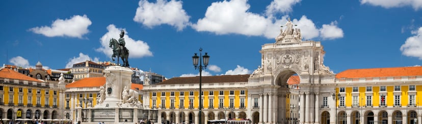


 So if you are looking for the absolute best in Lisbon & surroundings with authentic local fully-licensed native guides whose English you can actually understand and with an exclusive and amazingly fun itinerary