Madrid Río in Sequence: Royal Vistas, Industrial Reuse and the Manzanares

Updated
Read Madrid Río from the royal escarpment toward the industrial south
Madrid Río makes the most sense when it is treated as a southbound argument about the city, not as an invitation to wander until the river runs out. The Manzanares lies below the historic core, with the Royal Palace and Almudena Cathedral massing above the eastern side of the valley, Casa de Campo opening to the west, and a long civic landscape extending downstream toward Arganzuela and Legazpi. That geography gives the route its order. Begin where court Madrid faced the western roads, pass through the landscape made possible by burying sections of the M-30, let Puente de Toledo restore an older civic and monumental layer, and finish at Matadero Madrid, where municipal industry was recast as a cultural campus.
The sequence is especially useful for repeat visitors. It does not compete with the Prado, the palace interiors or the familiar plazas on their own terms. Instead, it explains why Madrid looks and moves differently at its western edge: a capital on a rise, a modest river once crowded by road infrastructure, bridges that preserve older approaches, and a twenty-first-century park that stitches together spaces previously divided by traffic. The payoff is cumulative. Puente de Segovia by itself is a historic bridge; Matadero by itself is an accomplished reuse project. Seen in the right order, they become the first and last chapters of one urban transformation.
This is also why the corridor should not be described as uniformly walkable. The park is continuous in a cartographic sense, but the interpretive anchors are unevenly spaced. Open lawns, playground zones, bridge approaches, bank changes and long planted stretches can either clarify the story or consume attention, depending on the route chosen. The municipal guide describes Madrid Río as almost ten kilometres long and shows branches toward Avenida de Portugal, Huerta de la Partida and Casa de Campo as well as the southward river corridor; consult the official Madrid Río guide and map for the full scale. The aim here is not to complete that map. It is to select the portion in which royal geography, buried-road landscape design, historic bridges and industrial reuse can be read without turning the day into an endurance exercise.
For wider trip planning, place this route on a day that is not already carrying two major interiors. It can support a larger three-day structure such as a carefully paced three-day Madrid itinerary, but it deserves its own intellectual space. A museum morning followed by the entire river sequence is possible only for fast walkers who are content to reduce Matadero to an exterior reading. A better assumption for an architecture- and history-led repeat visitor is a focused half-day, with the option to shorten one transition rather than stripping out the anchors that make the sequence coherent.
The four readings that make the route worth doing
The route has four non-interchangeable readings. The first is topographic: Madrid’s royal and ecclesiastical skyline occupies higher ground while the Manzanares marks a lower western edge. The second is infrastructural: the contemporary park exists because major road traffic was placed underground, freeing a connected surface for gardens, paths and civic use. The third is historical: bridges such as Puente de Segovia and Puente de Toledo show that the river corridor mattered long before the park was designed. The fourth is adaptive: Matadero preserves the scale and fabric of an industrial-municipal complex while giving it a different public purpose.
Each reading changes the meaning of the next. Without the royal overlook, the first bridge can feel like an isolated monument. Without noticing the buried road, the planted corridor can look like an unusually generous but conventional riverside park. Without Puente de Toledo, the journey risks collapsing four centuries of urban development into a before-and-after story about one infrastructure project. Without Matadero, the sequence ends in landscape architecture and misses the harder question of how Madrid has reused built fabric tied to slaughter, provisioning and municipal growth.
The core route therefore runs from Puente de Segovia to Matadero Madrid, generally following the Manzanares south. A practical planning allowance is roughly four to six kilometres of walking once bridge approaches, viewpoint adjustments and movement inside Matadero are included. That is an editorial estimate rather than an official measured itinerary; the exact figure changes with bank choice and crossings. Allow about three and a half to five hours for a serious reading without a scheduled performance or long exhibition visit. Faster versions are possible, but they should shorten a transfer rather than delete either the royal opening or the industrial conclusion.
- Opening anchor: Puente de Segovia and the palace-facing valley, where the royal approach and river geography become visible together.
- Infrastructure anchor: the continuous planted corridor created after sections of the M-30 were buried, read through changes in grade, path width, planting and connections across the river.
- Historic counterpoint: Puente de Toledo, which restores an older bridge-centred urban story before the route enters the broad spaces of Arganzuela.
- Final anchor: Matadero Madrid, where the sequence moves from landscape recovery to the reuse of a large industrial complex.
Begin at Puente de Segovia, where the river becomes a royal approach
Puente de Segovia is the correct beginning because it solves two interpretive problems at once. It establishes the Manzanares as a line of arrival and departure, and it places the Royal Palace above the river rather than treating the palace as an object floating in the city centre. The municipal heritage record identifies Puente de Segovia as Madrid’s oldest surviving bridge, links it to the establishment of the court under Felipe II and to the road from Segovia, and protects it as a monument. The official heritage entry for Puente de Segovia is valuable precisely because it frames the bridge as part of court geography, not merely as attractive masonry.
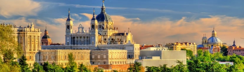
Start by resisting the impulse to hurry onto the river path. Spend time locating the vertical relationships. The palace and cathedral occupy the higher eastern ground; the river runs beneath; the western bank opens toward Casa de Campo; and the bridge carries the logic of an approach from beyond the city. Madrid is often experienced as a sequence of plazas and streets on the plateau. Here, the capital is better understood in section: ridge, descent, water, crossing and open land beyond. That change of viewpoint is the route’s first piece of information gain.
The best reading is not dependent on one perfect photographic point. Move enough to compare three views: along the bridge, upstream and back toward the royal skyline. The bridge’s arches and stone mass explain an older solution to crossing the river. The contemporary paths and planted areas around it show a later decision to make the crossing part of a public landscape. The palace above confirms why this location mattered politically and symbolically. Together, those views prevent the bridge from becoming a decorative preface.
For travelers who have not yet explored the palace quarter on foot, a separate Austrias and Royal Palace context walk should come before or on another day. It explains the court city from within its streets. Madrid Río does the opposite: it looks back at that city from the valley and asks how the capital meets its western edge. Combining both perspectives is productive; trying to compress both into the same long walk usually weakens them.
Use Puente de Segovia as a deliberate pause of around thirty to forty-five minutes, not as a pass-through. That allowance includes orienting the group, moving between viewpoints and clarifying what will change downstream. The route is southbound, but its opening gaze is often north and east, toward the royal city. Once the topography is understood, the rest of Madrid Río can be read as a series of interventions in the lower corridor.
Add the Puente del Rey branch only when western topography is a priority
There is a legitimate northern prelude: Puente del Rey, Huerta de la Partida and the connection toward Casa de Campo and Avenida de Portugal. The official city overview states that Madrid Río extends from Puente de los Franceses to Nudo Sur and includes a northwestern branch toward Avenida de Portugal; it also describes the Salón de Pinos as a connector among the principal garden areas. See the City of Madrid overview of the park for that official geographic frame.
This branch is useful when the reader’s priority is the relationship among the palace slope, Campo del Moro, Casa de Campo and the westward routes. It makes the royal landscape broader and shows that the Manzanares corridor is not simply a north-south promenade. It is less useful when Matadero is the non-negotiable final anchor, because every extra northern metre is paid for again downstream. The branch should be considered a prelude, not a harmless loop.
A sensible rule is to add it only when the group has at least another hour of walking capacity and is willing to keep later pauses concise. Begin near Puente del Rey, read the east-west axis, then proceed south to Puente de Segovia and continue with the core sequence. Do not add the branch after reaching Puente de Segovia; backtracking breaks the narrative and makes the route feel improvised. Travelers interested primarily in palace collections rather than topography will gain more from a dedicated court-collection sequence and should keep Madrid Río to its central-southern spine.
South of Segovia, look for evidence of a buried road rather than a picturesque river
The most important fact about Madrid Río’s contemporary form is also the easiest to overlook once trees, paths and play spaces begin to feel natural: the public landscape arose from the burial of sections of the M-30. The city’s own park description makes that origin explicit. This matters because the project is not simply beautification beside water. It is an urban repair operation over major infrastructure, and many of its design decisions respond to that condition.
Read the corridor for seams. Notice how broad planted areas narrow near bridge approaches; how paths rise, split or converge; how the park negotiates access to adjacent neighbourhoods; and how pedestrian connections attempt to overcome the river-and-road barrier that previously separated districts. The design is most legible where movement has to be solved, not where the lawn is at its calmest. A continuous pine-lined route, the Salón de Pinos, helps bind different garden areas, but continuity should not be mistaken for sameness. The character, width and civic intensity change as the route proceeds south.
The river itself is only one organizing line. Beneath or beside the visible landscape lies the memory of traffic infrastructure; above it are bridges and connections inherited from earlier Madrid; along it are newer spaces for play, exercise, gathering and movement. The value for an architecture-minded visitor is the overlap. Landscape architecture is doing several jobs at once: accommodating buried infrastructure, providing shade and routes, reconnecting neighbourhood edges, framing historic bridges, and making the Manzanares present in daily life.
This is where a generic “riverside stroll” description becomes actively unhelpful. It encourages the eye to search for water views and photogenic bridges while missing the engineering premise. A better question is: what had to be solved here so that this space could function as a park? At one point the answer may be grade. At another it may be a crossing, a retaining edge, a sequence of trees, or the way a path passes under a road bridge. Even without technical drawings, those constraints are visible when attention is directed toward them.
For the core itinerary, remain disciplined about bank changes. Crossing every attractive footbridge doubles back on the same geography and uses energy without necessarily adding meaning. Choose crossings when they improve one of three things: the view back toward the royal skyline, the understanding of a historic bridge, or the approach to Matadero. Otherwise, stay on the bank that gives the cleanest southward progression. The exact choice can change with works, heat, mobility and temporary closures, so the route judgment should be made on the day rather than treated as a permanent formula.
Allow roughly forty-five to seventy-five minutes between the Puente de Segovia reading and the next major historic anchor, depending on pace and how much design interpretation is desired. The lower end suits a group that understands the infrastructure premise quickly and prefers to keep moving. The higher end suits visitors who want to compare planting, ramps, bridge underpasses and neighbourhood connections. More time is not automatically better: once the principle is clear, repeated examples add distance faster than insight.
What to notice in the landscape-design layer
- Continuity over interruption: look for the devices that make a linear public realm feel connected despite roads, bridges, service access and changes in level.
- Historic structures inside a new system: older bridges are not isolated behind barriers; they have been reframed by paths, gardens and new sightlines.
- Different speeds sharing one corridor: walkers, runners, cyclists, families and people using play or sports areas do not experience the same route. A culturally focused walk should avoid treating the fastest line as the most informative one.
- Edges rather than centre lines: the most revealing views often occur where the park meets the city, because that is where reconnection can be judged.
- Planting as structure: tree lines and gardens are not merely decoration. They guide movement, establish scale and help turn infrastructure cover into a recognizable civic landscape.
These observations are editorial interpretations grounded in the project’s verified origin and mapped layout. They are not claims of access to engineering records or a tested route survey. Their purpose is to give the walk an analytic task: identify how infrastructure has been made legible, concealed or transformed at street level.
Puente de Toledo keeps the sequence historically honest
Puente de Toledo is the point at which the route must slow again. By now the buried-road transformation has become persuasive, and there is a risk of reading everything through the lens of contemporary urban design. The historic bridge interrupts that simplification. Its masonry, formal composition and monumental presence restore an older idea of crossing the Manzanares, one tied to routes, civic representation and the expansion of Madrid beyond the royal core.
The municipal audioguide’s ordering is useful evidence for the southbound logic. It places the Puente de Segovia gardens and bridge before Puente de Toledo, then continues through Parque de la Arganzuela toward the greenhouse and Matadero-area shell bridges. The official Madrid Río points-of-interest sequence does not dictate a private itinerary, but it confirms that these anchors belong to one legible downstream progression.
At Puente de Toledo, do not spend most of the pause trying to photograph the entire span. The more useful reading compares the bridge with its new setting. Ask how the approaches meet the park, how contemporary paths pass around or beneath the older structure, and how the river corridor changes in scale here. The bridge is both object and junction. Its value lies in showing that the park had to accommodate inherited monuments rather than clear a blank site.
A crossing can be worthwhile when the group wants to understand the bridge as a three-dimensional structure, but crossing and returning solely for symmetry may be a poor use of time. Viewpoint choice should serve the onward route toward Arganzuela. If heat or fatigue is already reducing attention, keep the bridge reading concise and reserve concentration for Matadero. The sequence needs Puente de Toledo as a historical correction; it does not require an exhaustive architectural study.
Plan approximately twenty-five to forty minutes here. The shorter pause establishes the historical layer and maintains momentum. The longer pause suits travelers with a specific interest in bridge architecture, Madrid’s southern approaches or the way the contemporary park frames older monuments. Beyond that, the route can become bridge-heavy and delay the shift from crossing history to civic landscape.
Arganzuela is the broad civic middle, not empty distance
South of Puente de Toledo, the scale opens. Parque de la Arganzuela is where Madrid Río most clearly behaves as everyday metropolitan space rather than a chain of heritage viewpoints. That change is essential to the thesis. The result of burying infrastructure was not only a more attractive route between monuments; it was a large public realm intended for repeated local use. A visitor should therefore expect periods in which the cultural meaning comes from patterns of activity, planting and connection rather than from a single object with a plaque.
This broad middle is also where itineraries tend to lose shape. Multiple paths, play areas and bridges make detours easy, and the visual openness can create the false impression that Matadero is close before it actually is. Keep one directional cue: south toward Legazpi and the Matadero complex on the eastern side of the river. Use one or two contemporary pedestrian crossings as evidence of reconnection, not as invitations to sample every bank.
The sculptural pedestrian bridges in the Arganzuela area are useful because they make movement itself visible. Their form announces that crossing the river has become part of public life rather than a purely vehicular necessity. Yet they should remain subordinate to the route’s historical structure. The bridge sequence already contains two major older crossings; the contemporary crossings now demonstrate a changed civic purpose. This contrast is more revealing than a catalogue of bridge names.
Arganzuela is also the natural place to assess the group’s remaining attention. If everyone is walking comfortably and still engaging with the design, continue on foot. If the corridor has begun to feel repetitive, shorten the final transition but preserve Matadero. A brief coordinated vehicle movement can be justified here for travelers with limited walking tolerance, but only if the pick-up and drop-off are planned around actual access points. An improvised collection beside a linear park can consume as much time as it saves. Transport is a tool for preserving the final interpretive anchor, not a separate attraction.
For most groups, allow forty-five to sixty minutes from the Puente de Toledo pause through the Arganzuela landscape to the Matadero edge, including one considered crossing or viewpoint. The route should feel spacious here. It should not become aimless.
Finish at Matadero, where landscape recovery meets industrial reuse
Matadero Madrid is the correct conclusion because it changes the medium of the story. Until this point, the transformation has been read largely through topography, bridges, paths, planting and buried infrastructure. At Matadero, the evidence becomes architectural and institutional. The visitor enters a campus whose scale, repetitive building fabric and industrial character preserve the memory of a municipal slaughterhouse and cattle market while supporting contemporary cultural uses.
Matadero’s official history records a complex of forty-eight buildings over 165,415 square metres, designed by Luis Bellido, begun in 1911 and inaugurated in 1924. Slaughterhouse use ended in 1996; a planning change in 2005 increased the role of cultural use. These figures matter because they prevent the site from being reduced to a stylish conversion. It was a major piece of city infrastructure with a long operational life, and its reuse had to work with an unusually extensive ensemble. The official history of Matadero Madrid provides the factual backbone for that reading.
Approach from the river rather than arriving first through Legazpi when following this sequence. The river-side arrival lets the campus appear as the final consequence of moving south through Madrid’s infrastructural edge. The relationship among water, bridges, former service territory and industrial buildings becomes easier to grasp. Arriving from the metro side is efficient for a standalone visit, but it weakens the accumulated geography that this itinerary is designed to reveal.
Inside the complex, begin with scale before programme. Look along the spaces between buildings, compare repeated rooflines and brickwork, and notice how circulation has been adapted for public access. The most important first question is not what exhibition is on, because programmes change. It is how the identity of a working complex has been retained while the use has shifted. Exterior fabric, courtyards, structural rhythm and the relationship among buildings provide durable evidence even when interior access varies.
The reuse is convincing precisely because it does not erase the industrial past. Contemporary cultural institutions often occupy a single landmark building; Matadero asks visitors to understand a system. Its many structures once belonged to a coordinated municipal function. Today, different cultural activities occupy that inherited field. The campus model makes adaptive reuse visible at urban scale: not one rescued façade, but a large precinct negotiating preservation, access, new programmes and public identity.
This is the moment to connect Matadero back to Puente de Segovia. Both are pieces of infrastructure that outlived their original historical conditions. The bridge still performs a crossing while carrying court-era meaning. Matadero no longer performs slaughterhouse work, yet its physical organization remains central to how the site is experienced. Madrid Río between them adds a third model: infrastructure placed below ground so that the surface can take on a new civic function. The route therefore offers three different modes of urban continuity—continued use, adaptive reuse and infrastructural concealment—rather than one simple story of old becoming new.
The nearby greenhouse and river crossings can extend the conclusion, but they should not distract from the campus reading. The municipal points-of-interest sequence includes the Invernadero and Matadero-area shell bridges after Arganzuela. Treat them as supporting evidence, subject to current access, not compulsory boxes. If a cultural programme inside Matadero is central to the day, check its specific schedule independently; the historical argument does not depend on assuming that every interior is open.
Allow at least sixty minutes for the exterior and campus-scale interpretation, and longer only when a specific exhibition, performance or architectural interior has been deliberately chosen. A rushed twenty-minute pass through the courtyards confirms that the buildings exist but does not explain the reuse. Conversely, adding unselected interiors can dissolve the route’s conclusion into an unrelated cultural afternoon. The finish should feel like synthesis.
The real cost is not distance alone
The corridor’s difficulty is often described in kilometres, but the more important costs are transitions in attention. The route begins with a concentrated royal vista, then enters a linear landscape where evidence is distributed. It tightens again at Puente de Toledo, opens through Arganzuela, and finally asks the visitor to read a large building complex. That alternation is intellectually rich, but it is not effortless. Each shift requires a new way of looking.
Walking speed is only one variable. Heat can make exposed sections feel longer; mixed-use paths can require more awareness; bridge approaches can add grade; and a group that stops for every river view can reach Matadero with little concentration left. The best pacing gives each anchor a distinct task and treats the spaces between as evidence, not as filler. When the task has been accomplished, continue.
There is also a return cost. Matadero is a logical endpoint because onward travel from Legazpi is easier than retracing the river. A loop back to Puente de Segovia is rarely justified for this interpretive purpose. Plan the day as a one-way movement and decide in advance how the group will leave the southern end. Public transport, a pre-arranged pick-up or a nearby onward plan can all work; the relevant point is to avoid discovering at the finish that the day still contains an unnecessary backtrack.
Food planning should follow the same principle. A long meal placed in the middle of the river sequence usually breaks the geographic argument and makes the second half feel like a separate outing. A concise pause is easier to absorb, while a substantial lunch or dinner fits more naturally after Matadero or after leaving the corridor. Travelers building a broader architecture day might compare this sequence with Madrid’s modern-architecture route across Gran Vía, Torres Blancas and AZCA; the river day is slower, more linear and more dependent on reading public space between named buildings.
Choose one of three coherent versions
The core southbound sequence
Begin at Puente de Segovia, spend enough time to establish the royal skyline and the bridge’s role as a western approach, then continue south through the designed landscape. Pause at Puente de Toledo, cross only when the viewpoint improves understanding, move through Arganzuela with one contemporary-connection reading, and finish at Matadero. This version best serves repeat visitors who want the full transformation thesis without walking the entire park. Allow three and a half to five hours and roughly four to six kilometres as a planning range.
This is the preferred version because every transition is earned. The royal opening explains the valley; the park demonstrates infrastructure conversion; Puente de Toledo deepens the historical span; Arganzuela shows civic scale; and Matadero turns the conclusion toward adaptive reuse. Nothing is included merely because it lies nearby.
The shorter version for limited walking tolerance
Keep Puente de Segovia and Matadero, because they are the opening and conclusion, and preserve at least one stretch of Madrid Río on foot so the buried-road landscape is experienced rather than summarized. After the royal reading, walk a selected central segment or move by vehicle to the Puente de Toledo or Arganzuela area, then continue to Matadero. The exact handoff depends on access, group mobility and conditions on the day.
This version should not be disguised as the full walk. Its strength is editorial compression: it chooses representative evidence from each layer. A guide can use the transfer to maintain continuity by explaining what the group is passing, but no narration substitutes fully for the spatial experience of moving through the park. The aim is to protect the sequence’s logic while reducing fatigue, not to claim equivalence.
The expanded version with the western branch
Begin at Puente del Rey or the Huerta de la Partida area, read the connection toward Casa de Campo and Avenida de Portugal, then proceed to Puente de Segovia and complete the core route. This version suits visitors interested in landscape systems, royal topography and the way Madrid’s western open spaces meet the river. It adds meaningful context, but also makes the final approach to Matadero longer.
Add the branch only when the day has generous walking capacity, mild conditions and no time-sensitive Matadero programme. It is a poor addition when the group is already combining the river with a major interior. In that case, the expanded route does not feel richer; it simply spends the attention needed for the conclusion.
When private sequencing materially improves the day
Madrid Río can be visited independently, but this particular argument benefits from a guide-led sequence when the objective is more than recreation. The corridor’s evidence is distributed, the strongest viewpoints do not all sit on one bank, and the distance between major anchors can make the historical layers blur. A knowledgeable guide adds value by deciding where to stop, when to cross, what to omit and how to connect the royal, infrastructural and industrial narratives without turning every bridge into a lecture.
Route coordination matters most for groups with unequal walking pace, repeat visitors protecting energy for an evening, and travelers who want Matadero to remain a substantial final stop. The relevant premium service is not ceremonial. It is the ability to align the start point, bank choice, optional branch, abbreviated transfer and endpoint so that the group encounters the evidence in a deliberate order. Where a vehicle is used, it should solve one defined movement problem; it should not shadow the walk or replace the river corridor with disconnected drop-offs.
The same discipline applies to the larger stay. A Madrid Río half-day can balance a museum-heavy itinerary, but only when it is not treated as leftover outdoor time. It is an urban-history route with its own concentration demands. Visitors considering bespoke support can place it beside other options through Orange Donut Tours’ private Madrid experiences, then decide whether the river should remain a focused specialist half-day or become the landscape component of a longer tailor-made day.
Know when the urban story is complete
The route is complete when four things have happened: the royal city has been seen from the Manzanares valley; the park has been understood as the surface result of buried road infrastructure; an older bridge has interrupted any single-era reading; and Matadero has shown how a major industrial complex can acquire a new cultural role without losing its scale. Once those four readings are secure, continuing south is optional rather than necessary.
Stop at Matadero for this itinerary. Do not continue toward Nudo Sur merely because the official park extends farther. The remaining corridor may suit cycling, local recreation or a different study of river ecology and metropolitan edges, but it does not strengthen the royal-to-industrial argument at the same rate. Completion is measured by interpretive closure, not by reaching the end of the map.
Likewise, stop adding branches when they begin to threaten the final hour at Matadero. The Puente del Rey and Casa de Campo prelude is worthwhile only if the group still reaches the industrial complex with time and attention. Extra crossings in Arganzuela are worthwhile only if they demonstrate reconnection more clearly than the previous one. A route of this length becomes more sophisticated through selection, not accumulation.
The decision in one view
For repeat visitors, the most coherent Madrid Río day begins at Puente de Segovia and ends at Matadero Madrid. Start with the palace above the river and the historic western approach; move south while reading the landscape as the civic surface of buried infrastructure; use Puente de Toledo to preserve the corridor’s longer history; treat Arganzuela as evidence of everyday metropolitan use; and finish by comparing Matadero’s adaptive reuse with the bridge and park systems already encountered.
Choose the core walk when the group can sustain four to six kilometres and several changes in interpretive focus. Use a selective transfer when walking tolerance would otherwise force Matadero out of the day. Add the northern branch only when royal topography and Casa de Campo connections are a principal interest. In every version, plan a one-way finish and resist the temptation to complete the full park for its own sake.
The long linear geography is where bespoke sequencing proves practical: through better decisions about starts, crossings, pauses, omissions and the final handoff. To discuss a private Madrid Río sequence built around your walking tolerance, architectural interests and wider stay, Inquire now.
If you’re interested in any private tours of Madrid, please reach out to us.



 So if you are looking for the absolute best in Madrid & surroundings with authentic local fully-licensed native guides whose English you can actually understand and with an exclusive and amazingly fun itinerary